Dive into our curated courses and learning materials to master the art of UAS mapping. Our courses are designed by industry experts to provide you with in-depth knowledge and hands-on skills in this rapidly evolving field.

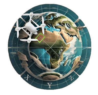
Foundations of UAS Mapping Course (UAS101)
Online
Join our "Foundations of UAS Mapping" course and unlock the world of drone-powered mapping. Whether you're a beginner or looking to expand your knowledge, this course provides a solid introduction to the essentials of UAS Mapping.
What You'll Learn:
- Terminology and Concepts: Understand the language of UAS Mapping.
- Types of UAVs: Explore drone diversity for mapping.
- Mapping Techniques: Learn how to turn images into precise maps.
- Advantages: Discover how UAS Mapping boosts efficiency.
- Limitations: Understand the challenges and constraints.
- FAA Licensing: Get guidance on becoming a licensed pilot (USA).
The UAS Mapping Foundation Course is designed to cater to a diverse audience interested in learning the fundamentals of UAS mapping and its practical applications.


UAS Mapping Professional Courses (Field/Office)
Virtual Classroom
Join our dynamic UAS Mapping Courses tailored to your preferences. Choose between mastering the field (flight) aspect or delving into the office (processing) side. Want the best of both worlds? Select both aspects and elevate your mapping skills. Join us now to unlock the full potential of UAS mapping expertise!
Field Courses Package:
- Foundation of UAS Mapping (UAS101)
- UAS Mission Planning (UAS201)
- UAS Flight Procedure (UAS202)
Office Courses Package:
- Foundation of UAS Mapping (UAS101)
- UAS Data Processing (UAS301)
- UAS Data Production (UAS302)
Throughout this course, you'll be guided by experienced instructors who are passionate about your success. Whether you're a beginner or seeking to enhance your skills, our UAS Mapping Course equips you with the tools to confidently embark on mapping projects that elevate your expertise. Enroll now to master the office or field aspect of UAS mapping, from planning to analyzing results!
UAS Data Georeferencing Courses
Online
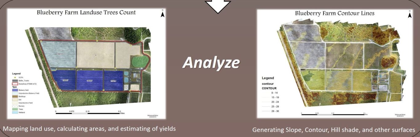
Master the art of Geo-referencing Aerial Imagery, a transformative process that seamlessly aligns visual data captured from above with precise geographic coordinates. This technique forms the bedrock of accurate map drafting, enabling you to craft intricate maps that mirror real-world features with unparalleled precision. Just as a skilled artist blends colors to create a masterpiece, Geo-referencing blends imagery and coordinates to create maps that resonate with accuracy and detail. This proficiency empowers you to fuse technology and spatial understanding, culminating in maps that are not just visuals but true reflections of the landscape. So, join us in acquiring the expertise to harness the power of Geo-referencing and transform aerial imagery into meticulously crafted maps that tell a story of precision and innovation.
Ebee Pilot Field Trainning
In person
Unlock the full potential of the Ebee fixed-wing (RGB) drone with our Comprehensive Training Program designed exclusively for drone pilot professionals. Dive deep into the world of this cutting-edge drone, and gain mastery over its specifications, capabilities, and operational intricacies.
Our training covers every aspect in the field work, from understanding its technical specifications to proficiently planning and executing missions. Learn to navigate the skies with confidence as you acquire essential flying skills, ensuring safe and efficient operations.
But that's not all – we emphasize the critical importance of quality control through thorough post-flight assessments. With our training, you'll be well-equipped to conduct meticulous quality checks, guaranteeing precise and reliable results in your aerial missions.
What sets us apart is the flexibility we offer. Our training sessions can take place at a location of your choice, making it convenient for you. The training is comprehensive yet efficient, typically lasting for one session, totaling approximately 6 hours of focused, personalized instruction, and practical application.
UAS Mapping Courses Curriculum
The UAS Mapping Courses are designed for:
- Mapping Enthusiasts: Individuals who have a keen interest in mapping, geography, and the use of technology to create precise maps.
- Drone Enthusiasts: Those who are passionate about drones and want to explore their applications beyond recreational flying.
- Students: Students pursuing degrees in fields related to geography, geomatics, environmental science, or engineering who want to gain practical mapping skills.
- GIS Professionals: Geographic Information System (GIS) professionals looking to expand their knowledge into the field of UAS mapping for more comprehensive data collection.
- Surveyors: Land surveyors interested in integrating unmanned aerial systems into their surveying workflows to enhance efficiency and accuracy.
- Environmental Scientists: Environmental scientists and researchers who require detailed spatial data for their studies.
- Engineering Professionals: Engineers who need precise mapping data for civil engineering, construction, or infrastructure projects.
- Remote Sensing Specialists: Professionals in remote sensing who want to explore drone-based data collection techniques.
- Government Agencies: Personnel from government agencies involved in land management, disaster response, or environmental monitoring.
- Anyone Curious About UAS Mapping: Individuals who are curious about the potential of Unmanned Aerial Systems (UAS) in mapping and want to explore this emerging field.
Throughout our course, you'll be guided by experienced instructors who are passionate about your success. Whether you're a beginner or seeking to enhance your skills, our UAS Mapping Courses equips you with the tools to confidently embark on mapping projects that elevate your expertise. Enroll now to master the aerial mapping journey, from planning to analyzing results!
UAS101: Introduction to UAS Mapping
Embark on your journey with a solid foundation. Understand the principles of UAS technology, mapping applications, and the essentials of flight planning.
UAS201: UAS Mission Planning
Dive into the intricacies of flight planning. Learn to choose optimal routes, set up equipment, and ensure safe operations for successful data collection.
UAS202: UAS Flight & Survey
Navigate the skies with confidence as you acquire hands-on skills in data acquisition. Explore different sensor technologies and capture data that forms the foundation of your maps.
UAS301/302: UAS Data Processing
Embark on your journey with a solid foundation. Understand the principles of UAS technology, mapping applications, and the essentials of flight planning.
UAS303/304: Ge-referencing & Data Production
Bring it all together in the final module. Interpret your maps and models to extract valuable information, making informed decisions that impact your projects.
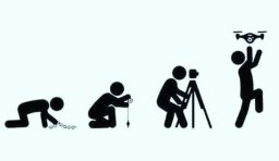
Our Mission
We bridge theory and practice in Geomatics, empowering both professionals and enthusiasts. Affordable access is our pledge, driving growth and progress for all.
We need your consent to load the translations
We use a third-party service to translate the website content that may collect data about your activity. Please review the details in the privacy policy and accept the service to view the translations.